Aerial Real Estate & Ranch Photography + Video in San Angelo, TX
Concho Valley Aerial Solutions provides FAA Part 107 certified drone photography and video for real estate listings, ranch and land sales, and commercial properties throughout San Angelo and West Texas. Our aerial photos and video are flown and edited by a locally based pilot with 12+ years of UAS experience, helping listings stand out and sell faster.
What's Included
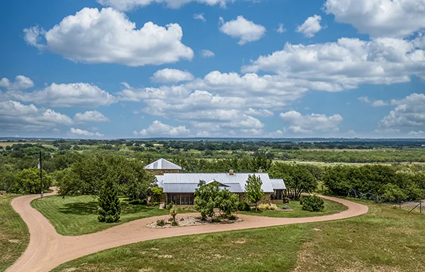
Every shoot pairs high-resolution aerial stills with cinematic video, giving agents and property owners a full marketing package instead of a handful of scattered images. We shoot on a large 4/3 sensor with adjustable aperture for clean, true-color stills in harsh Texas light, plus 48 MP telephoto cameras for compressed, magazine-style perspective shots. Files are delivered ready to drop into MLS listings, social media, and print materials.
- Aerial photography for residential and commercial listings
- Cinematic aerial video and property walkthroughs
- Ranch, land, and acreage photography and video
- New construction and development marketing
- Event and venue coverage
Built for West Texas Land
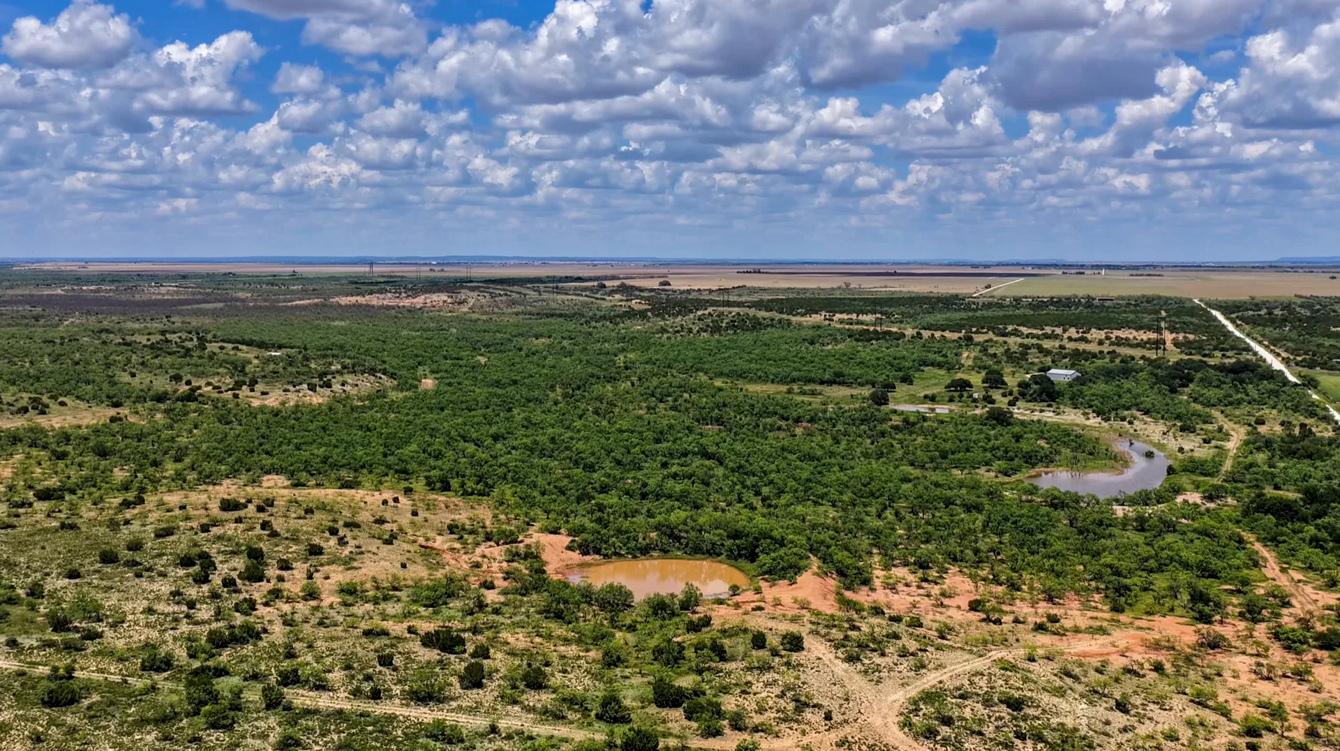
Ranch and acreage listings are one of the most requested services we fly. Ground-level photos cannot show a buyer the scale of hundreds of acres, where the fence lines run, how the water features connect, or what the terrain looks like from above. Aerial photography and video solve that problem, and it has become one of the most effective marketing tools for ranch, hunting lease, and rural property listings across the Concho Valley.
We fly the full property, not just the homesite, capturing tank ponds, tree cover, roads, pens, and boundary lines so buyers understand exactly what they are looking at before they ever set foot on the land.
Read more about marketing land with drone photography →Aerial Marketing Sells Listings Faster
Buyers scroll through dozens of listings before deciding which ones are worth a showing. A handful of ground-level phone photos rarely stops that scroll. Aerial photography does, because it shows context a buyer cannot get any other way: the lot size, the neighborhood layout, proximity to schools and highways, how the property sits relative to water, tree lines, and neighboring land. Properties marketed with professional aerial photos consistently see more engagement and sell faster than listings without it, and West Texas real estate agents are increasingly making it a standard part of every listing package rather than an upgrade.
For ranch and land listings specifically, aerial photography is not a nice-to-have. It is often the only practical way to show a buyer what hundreds of acres actually look like before they schedule an in-person visit, which saves both the buyer and the listing agent time.
From Booking to Delivery
Consultation
We talk through your property, the shots you need, and your listing timeline.
Flight Planning
We check local airspace and weather to schedule a flight window that works for you.
Capture
Our certified pilot flies the property, capturing stills and video from multiple angles.
Delivery
Edited photos and video are delivered ready for MLS, social, and print.
Real Estate & Ranch Photography FAQ
How much does drone real estate photography cost in San Angelo?
Pricing depends on the size of the property, whether video is included alongside stills, travel distance from San Angelo, and how quickly you need the gallery delivered. Contact us for a free quote based on your specific listing.
Do you photograph ranches and large acreage properties?
Yes. Ranch, land, and acreage photography is one of our most requested services. Aerial photos and video give buyers a real sense of scale, terrain, water features, and fence lines that ground-level photos cannot show.
Is it legal to fly a drone near San Angelo for real estate photography?
Yes, when flown by an FAA Part 107 certified pilot following federal regulations. San Angelo has real airspace considerations near Goodfellow Air Force Base and San Angelo Regional Airport, and some properties require additional authorization before a flight. We handle that airspace planning as part of every job.
How fast will I receive my real estate photos?
Most real estate galleries are edited and delivered within a few business days of the flight so they can keep pace with listing and marketing timelines.
What areas do you serve for real estate and ranch photography?
We are based in San Angelo and regularly travel throughout the Concho Valley and West Texas, including Midland, Odessa, Abilene, Big Spring, Sonora, Eldorado, Mertzon, Coleman, Brady, Menard, Mason, and Ballinger.
Explore More Drone Services
Aerial Mapping & Photogrammetry
Orthomosaic maps, point clouds, and elevation data for land development and planning.
Learn more →Construction Monitoring
Regular aerial progress documentation and volumetric data for construction projects.
Learn more →Full Portfolio
See real estate, ranch, and land photography examples from across West Texas.
View portfolio →Get Your Listing
Off the Ground
Request a free quote for real estate, ranch, or land photography anywhere in San Angelo and West Texas.