The agricultural industry in West Texas faces unique challenges , vast land areas, variable rainfall, thin margins, and the constant need to do more with less. Drone technology is proving to be one of the most practical tools for addressing these challenges, giving farmers and ranchers in the Concho Valley access to aerial data that was previously available only to large commercial operations with helicopter budgets.
What is Precision Agriculture?
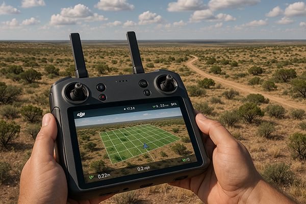
Precision agriculture is a data-driven approach to farm management , applying the right treatment, in the right place, at the right time. Instead of treating an entire field or pasture uniformly, precision agriculture uses spatial data to identify variability and respond to it precisely. Drones are one of the most cost-effective tools for gathering this data across the large parcels typical of West Texas operations.
Key Applications for West Texas Farms and Ranches
Crop Health Monitoring
Drones equipped with multispectral cameras can detect plant stress, disease, and nutrient deficiencies before they're visible to the naked eye. Early detection allows for targeted treatment , protecting yield and reducing the cost of inputs applied to healthy areas that don't need intervention.
Irrigation Assessment
Aerial imagery reveals irrigation coverage patterns across large fields, showing precisely which zones are under-irrigated or where system failures are occurring. In West Texas where water is the most critical input, catching these issues early pays for itself quickly.
Soil Mapping and Analysis
Aerial surveys combined with ground-truth data help map soil composition, moisture variation, and drainage patterns across fields. This information drives more precise fertilization plans and irrigation scheduling , reducing input waste while maximizing productivity.
Ranch and Livestock Surveys
For ranchers managing large acreage, drones provide efficient livestock counts, fence line inspections, water source assessments, and pasture condition surveys , in a fraction of the time required on horseback or by truck. We regularly conduct ranch surveys across the Concho Valley and surrounding counties.
Land and Infrastructure Assessment
- Fencing inspection across thousands of acres
- Stock tank and water source condition monitoring
- Terrain mapping for drainage planning and erosion control
- Water trough and stock tank condition surveys
- Pipeline and utility corridor monitoring
The Efficiency Advantage for Large Operations
West Texas agriculture is characterized by scale , operations that span hundreds or thousands of acres. Traditional ground-based scouting at that scale is time-consuming and often incomplete. A drone can cover hundreds of acres in a single flight, providing systematic coverage that's impossible to replicate on foot or in a truck. What takes days of manual scouting is accomplished in hours.
Working With a Professional vs. Operating Your Own Drone
Consumer drones and agricultural drones have become more accessible, but commercial operations require FAA Part 107 certification. More importantly, interpreting multispectral data, generating accurate orthomosaic maps, and producing actionable reports requires expertise beyond basic drone operation. A professional service provides certified pilots, professional-grade equipment, processed deliverables, and the experience to identify what the data means for your specific crops and conditions.
What Our Agricultural Services Deliver
- High-resolution aerial photography of fields, pastures, and infrastructure
- Orthomosaic maps with accurate measurements and GPS coordinates
- Multispectral analysis for crop health assessment (when applicable)
- 3D terrain models for drainage and erosion planning
- Livestock count and distribution surveys
- Actionable written reports with identified issues and recommendations
Specific Crops and Conditions in the Concho Valley
West Texas agriculture spans a remarkable range of operations. Cotton remains the dominant row crop in much of the region, with fields stretching across Tom Green, Concho, and Menard Counties. Aerial monitoring during the growing season — particularly during boll development — can catch irrigation deficiencies and pest pressure early enough to protect yield. Drone surveys during harvest preparation help producers assess field uniformity and identify areas that may require adjusted picker speed or settings.
Pecan orchards, increasingly common in the river bottom areas around San Angelo along the North and South Concho, benefit from aerial health monitoring that can identify stressed trees before visible decline sets in. Livestock operations, which form the backbone of the Concho Valley's agricultural economy, use drone surveys for everything from cattle counts across remote pastures to fence-line inspections on properties too large to cover efficiently by truck or horseback. A single morning flight can cover ground that would take two days to scout on foot.
Pipeline and Infrastructure Monitoring on Ranch Land
Many West Texas ranches overlay producing mineral leases, meaning landowners must manage both agricultural operations and energy infrastructure — pipelines, well pads, caliche roads, and associated facilities. Drone surveys are highly efficient for monitoring pipeline rights-of-way for erosion, unauthorized encroachment, or surface disturbance that might indicate subsurface issues. We regularly provide this service to landowners, operators, and mineral estate managers throughout the Permian Basin and Concho Valley region, helping them meet lease terms and identify surface damage before it becomes a larger problem.
Frequently Asked Questions
Do you need special equipment for agricultural drone surveys?
Standard high-resolution RGB cameras are sufficient for most ranch and farm applications — fencing inspection, livestock counts, pasture condition surveys, and general land assessment. Multispectral cameras, which capture light beyond the visible spectrum, are used for detailed crop health analysis where early stress detection is the goal. During our initial consultation we'll discuss which approach best fits your operation and budget.
How large a property can you survey in a single day?
A single pilot with standard equipment can cover 300–500 acres per day at full mapping resolution, and considerably more for reconnaissance-level photography and video. For large ranch properties, multi-day surveys can be scheduled to provide systematic coverage of the entire operation. We work with clients managing properties of all sizes across Tom Green, Concho, Menard, McCulloch, Irion, and surrounding counties.
How does drone surveying compare to satellite imagery for agriculture?
Drone surveys offer several significant advantages over satellite imagery: much higher resolution, the ability to fly on your schedule rather than waiting for a satellite pass, no cloud cover interference, and the ability to capture low-altitude oblique angles that satellite imagery cannot. For operations where timing is critical — identifying an irrigation failure or pest outbreak at a specific growth stage — on-demand drone surveys are far more actionable than satellite imagery subscriptions with unpredictable revisit times.
Can you help with USDA or crop insurance documentation?
Aerial imagery and orthomosaic maps are accepted as supporting documentation for many USDA Farm Service Agency programs and crop insurance claims. GPS-referenced imagery with accurate acreage calculations can support compliance documentation, acreage reporting, and damage assessments after weather events. We recommend discussing your specific program requirements before the survey so we can structure the deliverables to meet those needs directly.
Concho Valley Aerial: Your Local Agricultural Drone Partner
We're based in San Angelo and understand West Texas agriculture. Whether you're managing cotton fields in Tom Green County, ranches across the Concho Valley, or specialty operations elsewhere in the region, we bring the equipment and experience to deliver meaningful aerial data for your operation. All services are FAA Part 107 certified and fully insured.
See your land from above
Schedule an Agricultural Drone Survey
Concho Valley Aerial Solutions , San Angelo, Texas. Serving farms and ranches across West Texas.
Request a Quote